
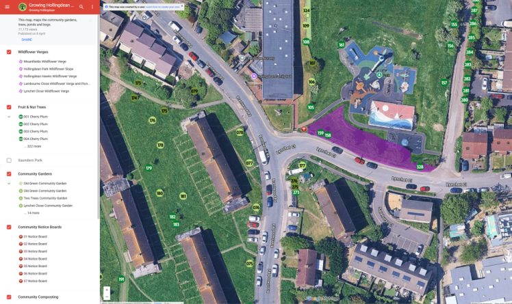
Growing Hollingdean’s Tree Map
Our Growing Hollingdean map is where you can find our fruit, nut and other trees, wildflower verges, community gardens, community orchards, ponds, a bog garden, a food forest and hedge. All planted and cared for by wonderful volunteers in the local area.

Light green – Pip Fruit Trees
Mid green – Other Fruit & Nut Trees
Dark green – Stone Fruit Trees
Help us look after these and they will look after you

We’re incredibly lucky to have so many green spaces in Hollingdean. Our volunteers help make these places extra special for local people and wildlife alike, while also supporting biodiversity and playing a small but important role in tackling the climate crisis. Every little bit helps. If you would like to join us we are always looking for volunteers from weeding to photography.
Keep up with Growing Hollingdean
For all the latest news about Growing Hollingdean, including free events, activities and volunteering opportunities, sign up to our mailing list here or use the sign-up box below.
And a huge thank you to all our wonderful Growing Hollingdean volunteers who helped make this possible!
We look forward to seeing you at our next event.
 Growing Hollingdean